










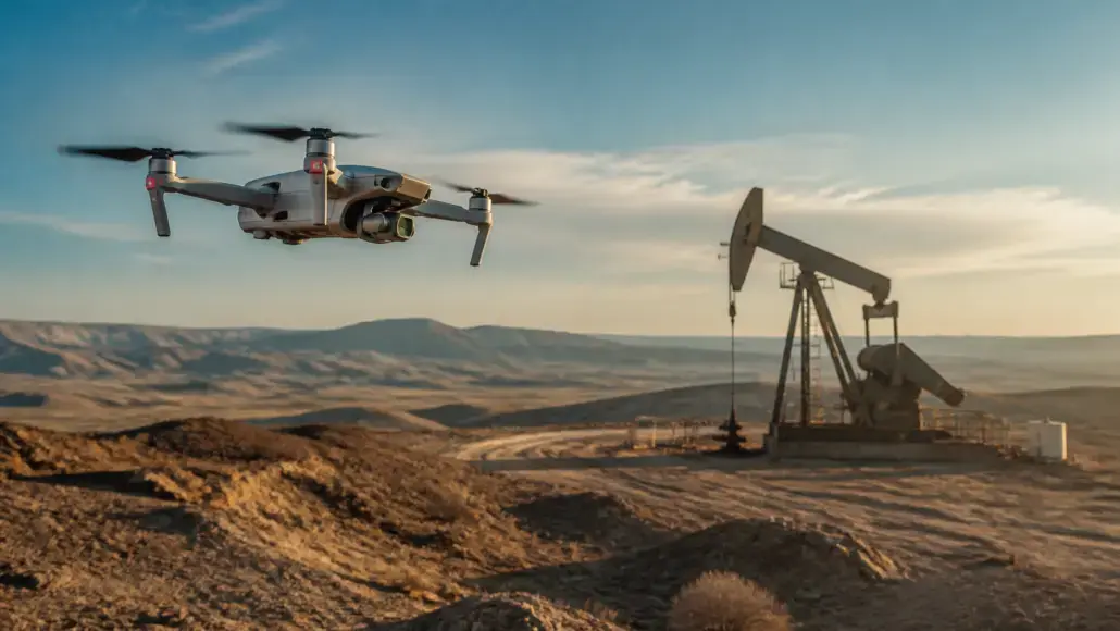
The exploration for hydrocarbons has historically been a labor-intensive and often dangerous endeavor, requiring teams of surveyors and geologists to traverse some of the most inhospitable terrains on the planet. From dense tropical jungles to frozen arctic tundras, the logistical challenges of mapping remote prospects have often dictated the pace of discovery. However, the emergence of drone technology in oil and gas exploration has fundamentally changed this dynamic. Unmanned Aerial Vehicles (UAVs) are no longer just novelties; they have become essential tools for aerial surveys, providing high-resolution data and mapping capabilities that were previously unattainable or prohibitively expensive.
Oil & Gas Advancement notes that by integrating drones into their exploration workflows, oil and gas companies can significantly reduce the risks associated with ground-based operations. Instead of sending personnel into hazardous or hard-to-reach areas, operators can deploy UAVs equipped with a variety of sophisticated sensors. Drone technology in oil and gas exploration allows for the rapid assessment of topographical features, geological outcrops, and potential drill sites with minimal environmental impact. This shift not only enhances safety but also accelerates the initial phases of exploration, allowing for more informed decision-making before any heavy machinery is moved into the field.
Revolutionizing Aerial Surveys and Geological Mapping
The primary advantage of using drones lies in their ability to capture data from a perspective that is both close to the ground and highly mobile. Traditional aerial surveys conducted with helicopters or fixed-wing aircraft often struggle with the resolution required for detailed geological mapping. In contrast, drone technology in oil and gas exploration provides centimeter-level accuracy through the use of photogrammetry and LiDAR (Light Detection and Ranging) sensors. These technologies create highly detailed 3D models of the surface, allowing geologists to analyze rock formations and structural features with extreme precision.
In remote prospects where vegetation is dense, LiDAR-equipped drones are particularly valuable. The laser pulses can penetrate the forest canopy to map the underlying terrain, revealing subtle geological signatures that would be invisible to the eye or standard cameras. This capability is a game-changer for drone technology in oil and gas exploration, as it enables the identification of faults, folds, and other structural traps that might host significant oil or gas reserves. By layering this topographical data with multispectral imagery, exploration teams can even identify surface seeps or anomalous vegetation patterns that indicate the presence of hydrocarbons below.
Enhancing Data Collection in Hard-to-Reach Areas
The logistical flexibility of UAVs is perhaps their most celebrated trait in the upstream sector. In many parts of the world, infrastructure is non-existent, and the cost of building roads just for initial site assessments is unjustifiable. Drone technology in oil and gas exploration bridges this gap by providing a eye in the sky that can be deployed from a small base or even a moving vehicle. This is particularly useful for pipeline route planning and environmental impact assessments, where understanding the terrain is critical to avoiding sensitive habitats or unstable ground.
Beyond simple mapping, drones are increasingly used for magnetic and gravity surveys. By carrying lightweight magnetometers, UAVs can fly systematic patterns over large areas to detect magnetic anomalies in the Earth’s crust. This data helps geophysicists understand the basement structure and the thickness of sedimentary basins. Drone technology in oil and gas exploration makes these geophysical surveys much more cost-effective than traditional methods, as it eliminates the need for expensive aircraft charters and the associated carbon footprint. The ability to collect high-quality data in a fraction of the time has made drones a staple in the modern explorer’s toolkit.
Integrating Drone Data into Digital Twin Workflows
The utility of drones does not end once the data is collected. The high-resolution imagery and point clouds generated by UAVs are increasingly being integrated into digital twins—virtual replicas of physical assets and environments. Drone technology in oil and gas exploration feeds these digital models with real-time updates, allowing project managers to monitor construction progress or site conditions from halfway across the world. This level of connectivity is essential for managing large-scale projects in remote prospects where site visits are difficult to coordinate.
Furthermore, the automation of drone flights is paving the way for more frequent and consistent data collection. Pre-programmed flight paths ensure that the same area is mapped in the exact same way every time, enabling time-series analysis to monitor environmental changes or land subsidence. This long-term monitoring is a critical component of drone technology in oil and gas exploration, ensuring that companies maintain their social license to operate by demonstrating a commitment to environmental stewardship. As battery life improves and beyond-visual-line-of-sight (BVLOS) regulations evolve, the scope of drone operations will only continue to expand.
Real-World Implementations: Case Studies in Extreme Environments
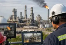
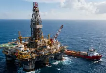
The versatility of drone technology in oil and gas exploration is best demonstrated through its application in extreme environments. In the North Sea, for instance, drones are routinely used for the inspection of offshore platforms and flare stacks. Previously, these inspections required rope-access teams and often necessitated partial shutdowns of production. Now, UAVs equipped with high-definition thermal cameras can identify structural defects or gas leaks while the platform remains fully operational. This not only saves millions of dollars in downtime but also significantly reduces the risk of injury to workers.
In the vast desert regions of the Middle East, drone technology in oil and gas exploration is being used to map seismic corridors across massive tracts of sand. Traditional seismic crews are limited by the speed of their vehicles and the harshness of the climate. By using autonomous drone swarms to scout the terrain and identify the best routes for heavy vibroseis trucks, companies can optimize their seismic surveys and reduce the time spent in the field. These real-world examples highlight how drones have moved from being experimental gadgets to mission-critical infrastructure in the quest for global energy security.
Navigating the Regulatory Landscape and Ethical Constraints
Despite the clear advantages, the widespread adoption of drone technology in oil and gas exploration is not without its challenges. One of the primary hurdles is the complex and often fragmented regulatory landscape governing the use of UAVs. In many countries, strict rules regarding BVLOS operations and airspace management can limit the scale of drone missions. Furthermore, the use of drones in sensitive border regions or areas of geopolitical conflict requires careful coordination with local authorities. Navigating these constraints is a critical part of the exploration workflow for any multinational energy company.
There are also ethical and security concerns associated with drone technology in oil and gas exploration. The same capabilities that make drones excellent for mapping also make them potential targets for cyberattacks or industrial espionage. Ensuring that the data collected by drones is encrypted and securely stored is a top priority for IT departments. Additionally, companies must be mindful of the privacy of local communities when conducting aerial surveys in populated areas. Developing clear ethical guidelines and maintaining transparency with stakeholders is essential for the continued social acceptance of drone-based exploration activities.
The Future of Autonomous Exploration: Swarms and AI Integration
Looking forward, the next stage of evolution for drone technology in oil and gas exploration will be the integration of artificial intelligence for real-time edge computing. Future drones will not just collect data; they will process it in flight, identifying geological anomalies or structural hazards and adjusting their flight paths accordingly. This intelligent exploration will allow for even more efficient mapping of remote prospects. Furthermore, the development of drone swarms—where multiple UAVs work together in a coordinated fashion—will enable the mapping of vast areas in a single mission, providing a holistic view of the subsurface that was previously impossible.
As the energy industry continues to evolve, the integration of drone technology in oil and gas exploration will likely move toward fully autonomous systems that can operate for weeks at a time without human intervention. These systems could be stationed at remote wellheads or offshore platforms, providing continuous monitoring and rapid response capabilities.
Future Trends: Autonomous Swarms and Environmental Stewardship
The future of drone technology in oil and gas exploration is intrinsically linked to the development of perpetual flight technologies. Experiments with solar-powered UAVs and tethered drones are already underway, promising a world where aerial monitoring is a constant, rather than an intermittent, activity. This continuous presence will be vital for environmental stewardship, allowing for the real-time detection of methane leaks or soil contamination. By providing a transparent and verifiable record of environmental performance, drones will help the industry maintain its social license to operate in an increasingly climate-conscious world. The data collected by these systems will form the basis of a new era of verified sustainability in energy production.
Furthermore, the rise of collaborative swarms will redefine the efficiency of large-scale surveys. Instead of a single drone covering an area, a swarm of dozens of interconnected UAVs will work together, sharing data and optimizing their flight paths in real-time. This collective intelligence will allow for the mapping of thousands of square kilometers in a single day, providing a level of detail and coverage that was previously unimaginable. For now, the focus remains on leveraging these agile tools to unlock the potential of the world’s most remote regions. Oil & Gas Advancement believes that by turning hard-to-reach areas into accessible data points, drones are ensuring that the next generation of energy discoveries is found with greater efficiency and less risk than ever before. The journey from manual surveying to autonomous aerial intelligence is a testament to the industry’s enduring commitment to innovation.
